This trip needed good weather for tops travel and navigation so a decision was made to delay departure for 24 hours from originally planned. This unfortunately meant that two of the registrants and the one reserve missed out due to work commitments and we departed with 8 trampers going in opposite directions. Departing Richmond at 7 we gathered at Tadmor for carpooling and briefing before two vehicles set off for two destinations – Courthouse Flat (party of 3) and Hodgekinson Rd, Tui (5). Your scribe was in the larger party and the first obstacle was a huge tree across the forestry access road. Quick thinking from Gion guided us under the tree (think limbo!) and we were on our way again.
3 hours got us to the summit of Conical Hill (1202m) and time for lunch. This is a stunning landscape of granite tors and underfoot a beach-like granite sand with expansive views over to the Nelson Lakes and Richmond Ranges.
The high cloud kept us reasonably cool. A further hour brought us to the Dart River, some 150m lower at the end of an easy ridge. We were glad to refill water bottles, noted two pitched tents and I taped a tell-tale on a tree to mark the route out of the river. Then followed a lung-busting 450m steep climb up a ridge north-west to point 1509 and 11km into our tramp. We were now on the Lookout Range proper, broad ridges nude of vegetation with uninterrupted views of the Mt Owen massif facing us front and centre.
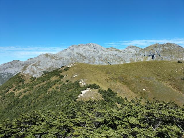 Mt Owen massif
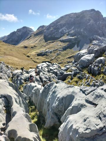
 Approaching the traverse under pt 1653
We traversed under point 1653 and for the first time since leaving Conical Hill we had some cairns to follow. Otherwise, this route is devoid of markers and doesn’t always follow what’s on the map. But that’s the challenge, and judging by the lack of actual track, not well used. Next was a roller-coaster descent to a short col at the headwaters of the Owen River and Granity Creek. Now the crunch – navigating a section of route under the limestone bluffs of Mt Bell. This is a heavily vegetated section and the going is tough. We clambered over spaniards, flax and giant hebes, traversed a short section of 60 degree hard scree with a bit of a drop-off and a rock climb. Tim found a tent all neatly rolled up but left out in the weather for ages. We tied green ribbon for additional markers as this section was hard to navigate. Eventually the markers started again, and we popped out onto Granity Pass. The last km to the hut seemed to take ages. 17.6km, 1820m of ascent, 10h20m elapsed time. 5 exhausted trampers.
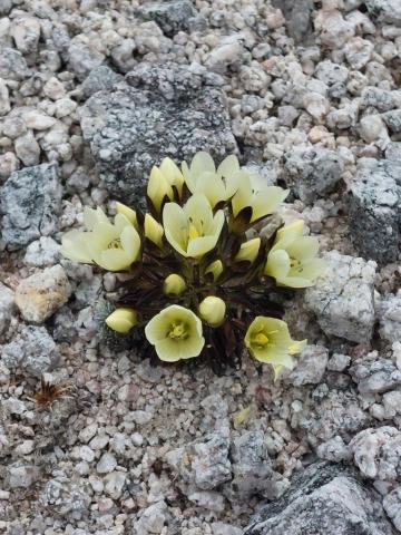 Cream Gentian only found on the Lookout Range
The hut was full to overflowing, perhaps 25 people in and around the 12-bunker. All good. Stories abounded as we connected with the rest of the party.
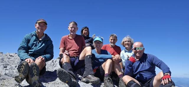
Day 2. Summit day. The day dawned to clear skies and the calls of kea, weka and Shane’s snoring. Mt Owen got the vote over Culliford Hill. Mike was not feeling too flash so 7 of us set off for the highest point in Kahurangi. What a complete stunner with not a cloud in the sky, the kaast landscape of Mt Owen was at its best. “CAPTURE” Kath commanded as her phone took a selfie of the group atop Mt Owen, all smiles! We were on top of the world with mountains stretching off in all directions. We were back at the hut shortly after 2.30pm. 750m climbing, 9.3km, 5.5hrs.
 Tramping is FUN
Day 3. Kath and Era set off at 7am for their big day and the rest of us down to Courthouse Flat via Blue Creek. We detoured to the Blue Creek resurgence on the way down. Personally, I was glad this was a shorter day as day 1 had taken the edge off my energy! About 4 hours and 9km (I forgot to press STOP!) It took Kath and Era 12 hours to get out and they were absolutely done in. Apart from scenic highlights they happened on a bag of chocolates on Conical Hill. This was fortunate – the broad top of Conical Hill would hide a lot of bags of chocolates. A little birdie has told me the donor was Andrea, so we now know who was camping at Dart River!
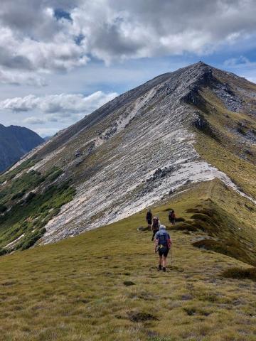
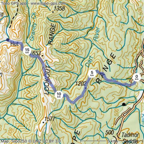 Route Granity hut via Conical Peak
Thanks everyone – that was a hell of a tramp!
Participants: David (leader & scribe), Kath, Heidi, Era, Shane (visitor), Mike, Tim and Gion.