
My plan was to explore lesser known areas of the Westcoast, plus some old favourites over 2 weeks. We had to cut it short because of west coast rains.
On the 4th, Steve and Astrid met at the very scenic Cameron Flat DoC camp, opposite Blue Pools Walk. Janey and Chrissy were still at Okarito lagoon, after exploring the Hokitika area for a week or so.
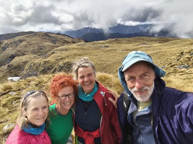 Us on Mataketake Tops and hut
The track up to Brewster Hut is steep, but luckily short, about 2.5 hrs, 1000m altitude. The hut sits perfectly on a plateau, with vista all around. We had scored 1 of the 12 very sought after bunks. There is plenty of good camping around the hut, too. We also met lots of groups heading to camp closer to the glacier.
 Brewster Hut
After a leisurely lunch on the sunny verandah, we visited the Brewster glacier. It’s a cairned track, easy to follow, about 3.5hrs return, 300m up. I struggled to stay awake to watch a stunning sunset – at 9.40pm!
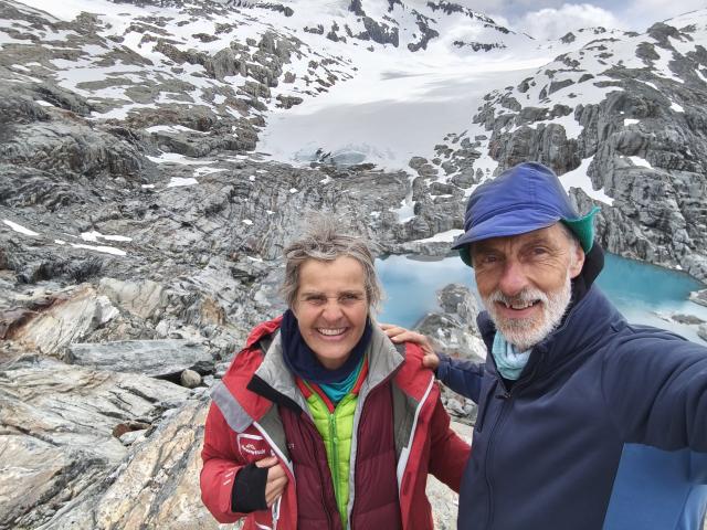 brewster glacier
The next morning, the ranger popped up in the hut, after quickly scaling the 1000m climb, just to clean the toilets. He walked down again after an hour! We quizzed him about the latest forecast and conditions. Luckily, we had reception, so I could contact our tramping buddies at Okarito and DoC Haast. We shifted our booking for Matakatake Hut, due to rain coming in on the 8th. We drove to the Northern Car Park of the Paringa Haast Cattle Track. From there, it’s an easy hour walk to the historic Blowfly/Blue River Hut from 1904.
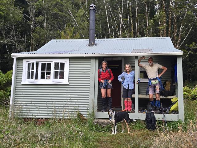 Blowfly Hut
Here, we united with our trip buddies Janey and Chrissy, had a dip in the Moeraki river (sandy beach!) and discussed our adjusted plans and what gear to take. We decided to leave our tents at Blowfly hut and just take 1 nights’ supplies plus emergency food up to Matakatake hut, where we had bunks booked. We borrowed a dog for the group photo.
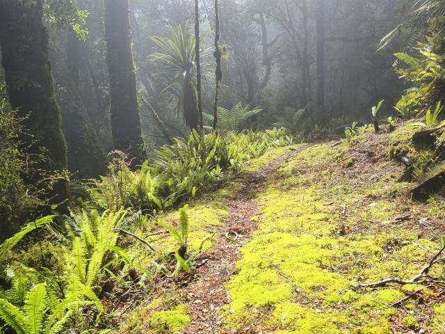
On 7th, we traversed lush west coast forest before climbing up the steep the Mica Mine Tops Route.
 Beautiful West Coast forest on the Mica Mine Tops Route
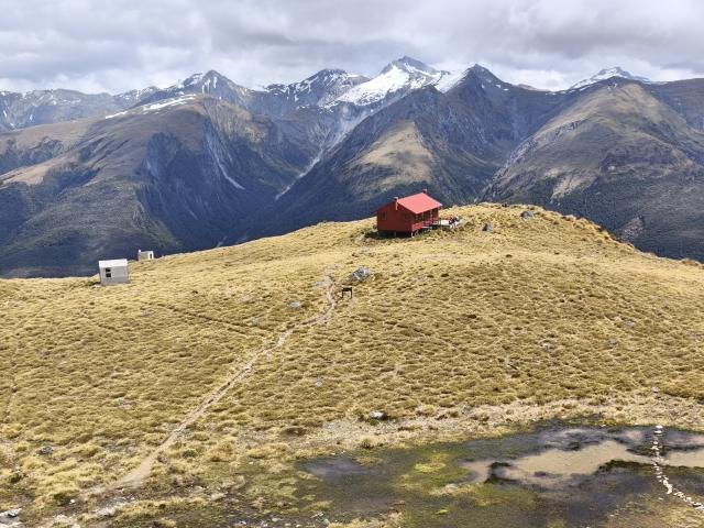
The route is easy to follow, lots of poles. We enjoyed the views during long breaks, knowing the weather would pack in the next day. We took the 6.5hrs indicated by DoC, including plenty of stops. The hut was donated by Andy Dennis, a Nelson conservationist (1944-2016). He chose the spot based on scenery, connection with the historic Cattle Track and plentiful bird life. We heard and saw lots of Kaka, but also Kea and frogs. The Mataketake hut is very cosy inside, with Andy’s full library! Bigger than most of ours!
We had planned to walk out the next day before streams rising and the tops clouding in. However, we were able to double check the forecasts (on a knob with reception just behind the hut) and to book beds online for another night. We had totally fallen in love with the hut by then. We put all our emergency food on the table and decided we had enough to share and go on a diet for 1 day! We explored the Mataketake plateau, tarns, lake life, then returned when the rain arrived and spent a peaceful afternoon reading books.
On the morning of the 9th, the clouds hang low and thick. There was no point following the Mica Mine Route out again in these conditions. Instead, we followed the poles down to Maori Saddle Hut, where we had a short break from the rain. We knew that some streams would become impassable after heavy rain (see photo with Janey crossing). So, we pushed on to the Blowfly Hut. The streams had certainly risen!
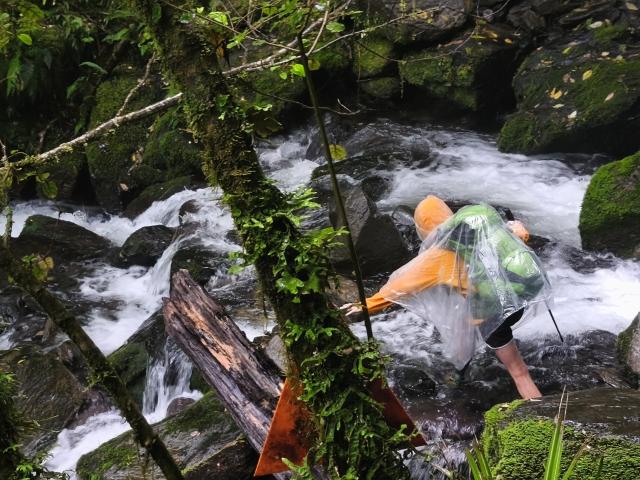 Janey stream crossing near Maori Saddle Hut
The old Paringa Cattle track was built in the 1870s and was once the old “road” from Paringa to Haast, the most difficult part of the old South West “Highway”. While a lot of the highway used to run along the beach, skirting headlands and bluffs, it was impossible to follow the beach along this section. When the highway to Haast and Queenstown was completed in 1960, conservationists campaigned hard to maintain the old cattle trail for tramping. The huts along the trail are historic, small and full of character. Despite its bad reputation, I would highly recommend the Paringa Cattle trail (3 days) for a Westcoast bush experience. The bush is outstandingly pretty, covered in ferns, mosses, lichen, orchids and gigantic tree fungi.
 Paringa Haast cattle Track
Back at Blowfly hut after about 5hrs, having eaten all our snacks, we wolfed down a late lunch and re-assembled our gear that we had stored there (in a cupboard!). Janey had to go back to work. Chrissy joined her, walking out and driving to Franz Josef to stay the night. Steve and Astrid remained at Blowfly for another peaceful night. On the 10th, we walked out. As predicted, the rain was heavy and the track partly under water, but easily walkable. Crossing the swing bridge again showed a raging Moeraki River.
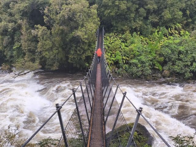 Moeraki river raging
No problems getting back to the cars in under 1 hr. When we got back into reception, DoC had emailed that they were closing the Welcome Fat track. We decided to stay in Franz for the rainy night. But after talking to DoC there and updating the forecast, we both drove home – very spontaneously! We had planned to (instead of Stafford Bay, Welcome Flat and Mt Fox) do some walks near lake Kaniere: Mt Brown and Rapid Creek Huts, Water Race, Mt Watson near Punakaiki, but the thought of flooded roads, muddy tracks and swollen rivers put us off. I now have plenty of ideas for another trip to explore more tracks in the back of Hokitika!
Participants: Astrid (leader and scribe), Steve, Christine and Janey.