
The weather in Murchison looked marginal for the planned 1000 acre plateau Easter tramp, so the Leader made the call to do something more local and less exposed to the incoming weather. The Bryant Range runs behind Nelson- literally it’s our back yard. But it is also part of the popular TA Trail and is ”busy- as” for most of the Spring and Summer. For those of us looking to escape the crowds, autumn provides the chance to walk the track, and that was Plan B!
With two car loads, it was decided to do a cross-over with one group starting at the Pelorus end and the other from the Hacket Valley. After meeting in Richmond to do the car swap and collect passengers, it was ready, set, go with our group of four heading to the start of what is called the ‘Pelorus River Track’ upstream from Pelorus Bridge. It took just over an hour and half to drive from Nelson.
From the car-park at the road-end, it was an hours walk to the lovely Emerald Pool where we found one tent and a smouldering fire. Very soon a large group of young people arrived and after much bantering three brave lads jumped/dived into the clear, clean light green water. One of our group ‘H’ found the water too enticing and joined the boys for a quick fresh dip! It was morning tea for the rest!
After that short break, our group made the climb up from the river bank to take the long sidle to Captains Creek Hut (CCH). It is a very pretty walk with native bush and regular glimpses of the river below. The track was a little slippery and steep sided in places requiring careful foot placement. Unfortunately as we started to descend towards CCH, H’s foot slipped and she fell awkwardly. After a brief recovery, we continued to the Hut for a longer lunch break and to see how the knee felt.
Middy Hut was a further two hours upstream. The track largely followed the river but from higher ground above. There was not too much climbing involved, so we pushed on arriving at 5.30 at Middy to find another couple (and their dog) having set up camp and enjoying the late afternoon sun. Two more tents were erected and two chose to stay in the comfort of the Hut. So after a vigorous refresh in the river, we all adjourned to the Hut to prepare our meals on the spotless stainless steel bench. {Both CCH and Middy have been refurbished and were bright cheerful huts…. presumably as a TA upgrade?
Day 2 required a steep 700 m climb to get to Rocks Hut. H’s knee was still feeling a bit tender, so the best option was the easier, shorter return to the Road-end with the cross-over group likely to catch up with her, possibly at CCH? So it was just the three of us that started the 3 hr climb to Rocks. The cross–over group had planned to stay the night at Rocks Hut, so we expected to meet them “on the hill”, and do the key-swap…. which we did.! They warned us of what was ahead.
After a short break for lunch at Rocks Hut, we headed off on what looked like on the topo map to be a much easier ‘amble’ following a long ridgeline towards the steep descent to Browning Hut. It turned out to be quite an obstacle course! [As advised by the other half of our group!]
Firstly we encountered a rough muddy section; then rocks and roots requiring very careful foot work; then some pleasant bush tracks; then old windfall with narrow tracks through thick fern hiding rocks, holes and small logs….and then we repeated the cycle! We didn’t have anything really steep but it was slow going. Eventually we reached the highest point of 1000m before the steep descent to Totara Saddle. We had travelled 10.5 kms at that point. Then came the steep descent to Totara Saddle at 690m before dropping even more steeply to Browning Hut at about 480 m. It had been a big day covering 15.5 km and nearly 1050m climbing and 730m of descent.
It was a latish arrival at Browning Hut as some low cloud started to cover the hilltops. It was quite busy with one tent; 5 people and two large dogs (one being very noisy). However, a quick meal, a few anti-flams and we were horizontal…too tired for too much talk.
The next morning dawned fine, so after a quick breakfast we were on our way to the Hacket carpark, 8km and 2.5 hours down the track. We had done it, and we had new respect for the TA walkers who find the Richmond Ranges the “toughest” part of their journey!
 Group 1 Team
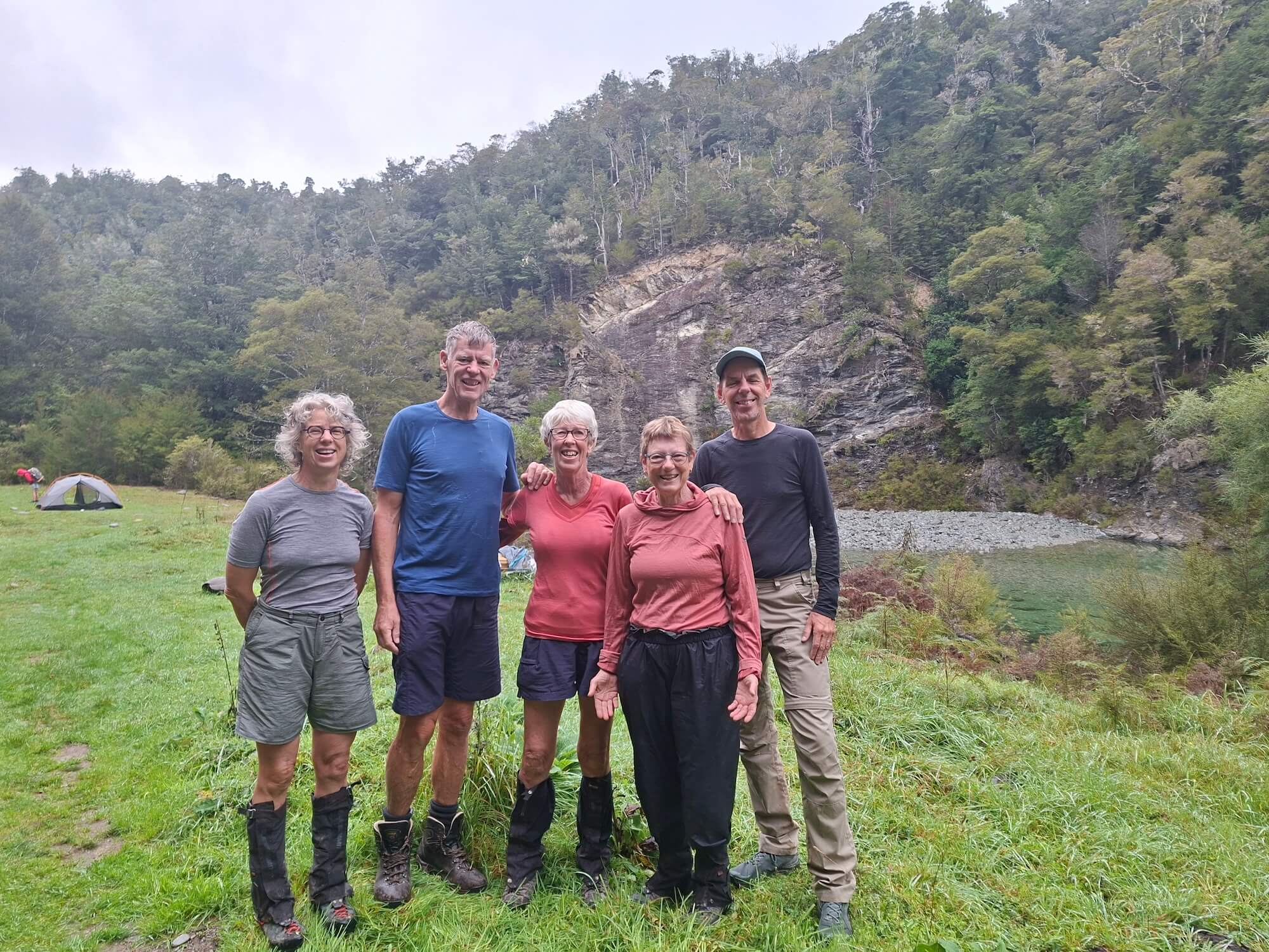
Walkers:- Mike, Kath, Hilde and Graeme. Stats; 34km; 1600m of elevation gain; 14 hrs walking.
The other group of five walked from the Hacket carpark to Pelorus end-of-road carpark.
On Friday we started out from the Hacket carpark in Aniseed valley at about 09:00 on a beautiful morning. The first bit was the easy walk to the Hacket hut where we had a leisurely break before setting out to Browning hut. Soon we were in the bush. The stretch to Browning took a bit longer than we anticipated due to the scrambles up-and-down over slips (including 1 major slip). Apart from those minor scrambles we did not have much elevation gain.
We arrived at 12:45 at the Browning hut where we had lunch. Then we went on at around 13:10 and started our climb towards the Totara saddle. We were still in the bush. Beyond Totara saddle at about 690m we continued climbing about 140m to emerge from the bush into the open mineral belt and got some great views. By that time we had realized that the walk from Browning hut to Rocks hut would take us considerably longer than we had estimated so we didn’t stop very long to take in the views.
After about 1 km in the open we went back into the bush where we stayed all the way to Rocks hut. We climbed another 100 m to about 1000m elevation and from there it was slow going up and down through the bush on a track with plenty of tree roots. We had a few mishaps: 2 slipping falls (Jo and Beth), probably partially due to tiredness towards the end of the day, and wasp stings (Beth and Maaike). Gaiters are a good idea this time of the year!
At long last (about 5 hours from Browning hut) we reached Rocks hut at 18:00 hrs. The hut was full and we all camped at the designated tent site in the bush behind the hut. We met 3 other Club members (Ray, Kathy, Linda) on their own adventures there, which was fun! There was sociable cooking and eating. We were knackered and went to sleep early. The skies were still clear but we were too tired to enjoy the full moon and starry skies.
Day 2 – After a leisurely breakfast and pack up we left our packs in the hut and walked up to the ridge above Rocks Hut. The sign said 10 mins to a lookout, but we carried on to the top of the ridge which was a 30 min walk. Lovely views out over Tasman Bay, the Coppermine track and east to Mt Richmond and Mt Fell.
We then headed down the track to the Pelorus River and Middy hut, meeting the other group around half-way. We had lunch at Middy and Jo, Beth and Maaike had a refreshing dip in the river to cool down. From Middy to Captains Creek hut the track was fairly rooty and up and down above the river, so required a bit of concentration. We arrived at Captains Creek hut to meet Hilde and in good time to set up a couple of tents, have another swim in the glorious Pelorus River, and make dinner.
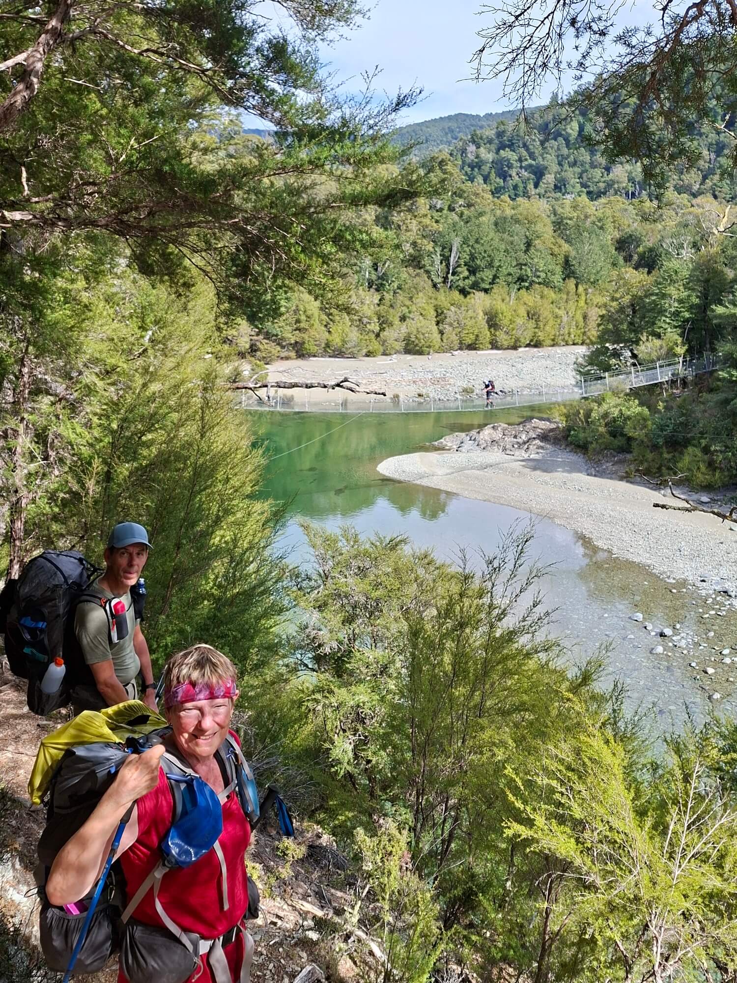 Pelorus swing bridge
On Sunday, after some overnight rain, we woke up to the smell of scrambled eggs and hot cross buns. Unfortunately, these delicacies were not ours to eat and belonged to the other tramping party. We settled for our usual breakfasts, and Maaike surprised us with some chocolate easter eggs. We encouraged David to fulfil a lifelong wish and be the Easter bunny, but that offer was respectfully declined.
We set off at 8.30am to our final destination while Hilde had left an hour before us. She must have done well, thankfully, as we didn't see her again on the trail. The track continued as we had left it, with ups and downs, rooty under our feet and with steep drop offs. The forest was stunning and birdsong guided us along. One of many highlights were the Emerald Pools, a beautiful section of the Pelorus river. It's not hard to imagine where it got its name from; if there is such a thing as paradise, might this be it? (If one ignored the sandflies). Jo braved the cold water and had a refreshing dip. After a hearty lunch, we mosied (or dandered, a word we enriched our vocabulary with) on to the carpark where we arrived at 1.30pm.
After a short drive, we rewarded ourselves with a coffee at the café. There we got a message from Hilde that she had been picked up by her husband. Under sunny skies, David then skilfully drove us back to reality. Thank you so much Maaike for organising and thank you all for great company.
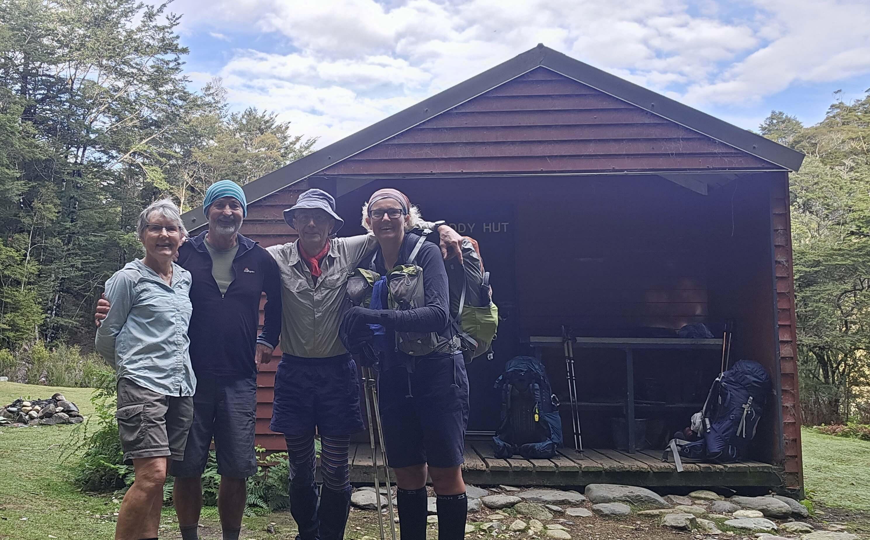 Group 2 Team
Walkers:- David, Beth, Axel, Jo, and Maaike. Stats according to David’s Strava: Distance 39:88 km; 1728m of elevation gain.